


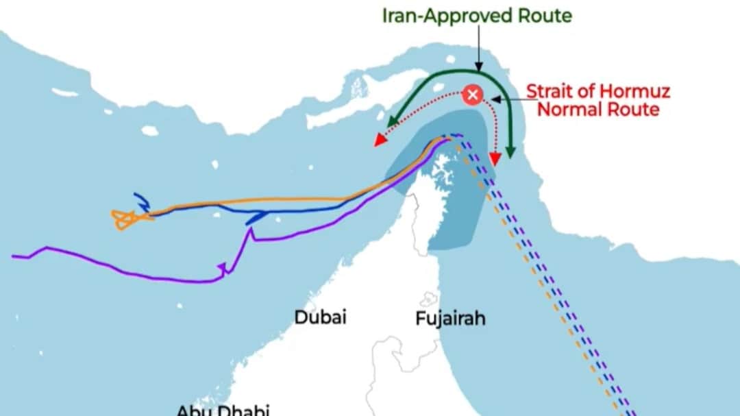
NDTV Datafy Uses OSINT, Satellite Mapping To Track Potential New Route In Strait Of Hormuz — Watch
The analysis, shared by NDTV's Editor-In-Chief Rahul Kanwal in a post on X, combined publicly available satellite imagery with vessel-tracking data to map changing shipping behaviours in and around one of the world's most important chokepoints for global energy supplies.
The analysis, shared by NDTV's Editor-In-Chief Rahul Kanwal in a post on X, combined publicly available satellite imagery with vessel-tracking data to map changing shipping behaviours in and around one of the world's most important chokepoints for global energy supplies.
What's Your Reaction?